
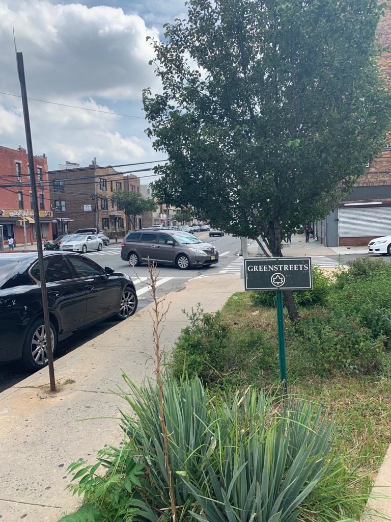
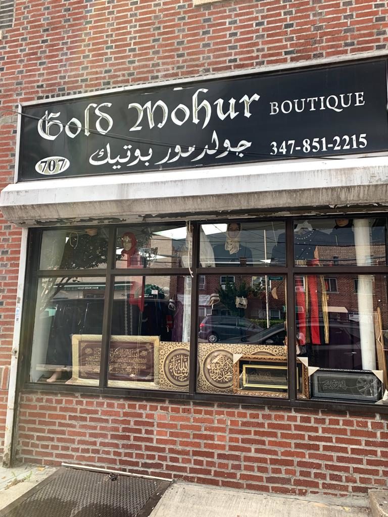
At a small intersection with an under-developed park called Green Streets, no longer than the length of three tightly parked cars, lies the center of Little Yemen in Morris Park. Door-to-door services crowd the street in front, including Al-Meraj, a halal meat market, and Gamal Business Services, where Arabic-language employees provide tax, translation, and notary services.
For Yahay Obeid, this is also the center of his dream.
Obeid, a control supervisor at JFK Airport, serves on Community Board 11 as the public committee safety chair and is the outreach liaison for his local mosque. His current mission is to establish the enclave’s identity as Little Yemen on Google Maps.
Obeid wants the official designation because it will encourage residents to feel a sense of belonging and pride in the Bronx, he said.
His goal is to give residents “a place where they can say, ‘Yeah, I’m waiting for you at the Little Yemen triangle.’”
The heart of the neighborhood is on White Plains Road and Rhinelander Avenue, where the most popular Yemeni restaurant, Arth Aljanatain, is located. The restaurant’s windowed walls offer a view of Green Streets, where passersby can see local Yemeni customers sitting on one of their eight tables. It’s where the coach of the Yemen United Soccer Club takes his his sons for dishes such as salta, a meat broth-based soup, and rice and chicken dishes. The main mosque of the area – that holds two Friday prayer services to accommodate the worshippers – is here too. Hookah cafes, a Yemeni supermarket, and Yemeni delis and pharmacies surround that one intersection.
Little Yemen, which encompasses pockets from Van Nest and Bronx Park East, is a small pocket of the approximate 120,000 residents in the area, according to the NYU Furman Center.
And it’s even a smaller fraction of the approximate 6,900 Yemenis in New York State, estimated by the Arab American Institute Foundation. The number of Yemenis residing in the Bronx and specifically in District 11 is unclear to community officials.
Obeid got the idea to reach out to Google earlier this summer, when he took part in the planning of the city’s first-ever Yemeni-American Day Parade. Anwar Alomaisi, the parade’s volunteer photographer, took a drone photo that captured the crowd at the triangle intersection. Once Obeid saw it, he was inspired to try to create “Little Yemen.”
Obeid submitted his request to Google using its My Business mobile application. Google verified the location and a few weeks later, Little Yemen was on the map. Sort of. It appears on Google Maps as a museum open 24/7. All Google Maps users can also manually add suggestions for businesses, hospitals, streets, and other places, where it will go through a verification process, but they cannot add neighborhoods.
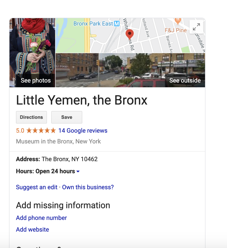
“It might not be an official museum, but people will check it out,” Obeid said about the designation.
Separately, Obeid has made a request to the Department of Parks and Recreation to rename the park to “Little Yemen.” He will reach out to Google to change the museum designation if the park is renamed with a sponsorship from the Department of Parks and Recreation.
In the meanwhile, “it will be somewhat of an outdoor museum of the Yemeni community.”
Google retrieves neighborhood information from third-party providers and public sources that they describe as local government websites and transportation operators, according to a Google Spokesperson.
They define borders with a red outline to map boundaries.
Establishing Little Yemen on the map would solidify the Arab presence in the area, said Jeremy Warneke, Community Board 11 District Manager.
“They’re very visible and present, and you can either embrace the future or do your best to deny it,” Warneke said.
Ethnic enclaves, or Littles, in New York City, are typically defined by “commercial, residential, and institutional concentration of a particular ethnic group,” said Tarry Hum, Professor and Chair of the Department of Urban Studies at Queens College, CUNY
She notes that neighborhoods develop out of “reciprocity and ethnic solidarity, class relations (and conflict) [that are] tempered by shared culture, language, experience of racial discrimination.”
Many Littles in New York don’t appear on Google Maps. The New York Times mapped out several based on population concentrations. In the Bronx alone, there are at least six distinctive neighborhoods, including Little Ireland in Woodlawn Heights, Little Albania in Pelham Parkway, and Little Ghana in Concourse Village, which are just some of the 30 Littles the Bronx Ink identified throughout New York City.
Obeid considers his efforts “a gift to the Yemeni community.”
“Now they see us out of the grocery stores.”
On October 3, 2019, a few weeks after this story went live, The Bronx Ink discovered that Little Yemen’s designation on Google Maps changed from museum to neighborhood. The new designation can be viewed by clicking this Google Maps link.
This story was updated to reflect the following correction: Yahay made the request to change the name of the park to the Department of Parks and Recreation, not the community board.
Me Gusta!!!
i live in the building across the street from the mosque and the building on top of the market call “amani”